Map of Istanbul, Istanbul Maps, Tourist Maps
This page gives you all the maps you need to navigate Istanbul in one place. Istanbul Walking map, links to Metro Map and Ferry lines/schedules, and interactive maps. Walking and getting around in Istanbul made simple.
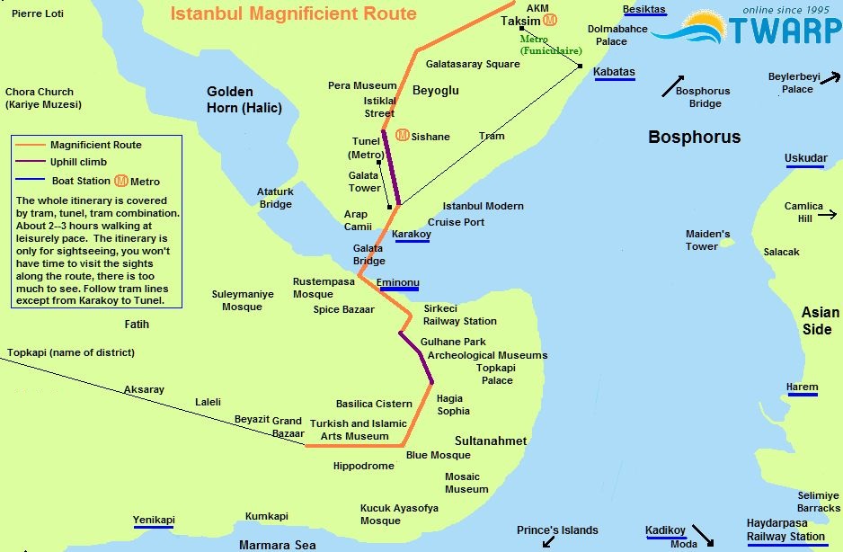
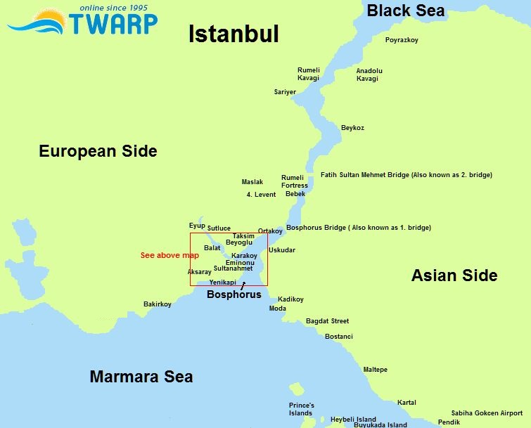
📌 Static Maps (top): Great for planning. Shows landmarks with clickable links to detailed guides. Print them, use as rough guide, take notes, mark on them. No street clutter — just the big picture.
📍 Interactive Maps (bottom): OpenStreetMap and Google Maps button show your current location on detailed street maps. Best for navigation while walking, without losing sight of major sights.
➡️ Use static maps to plan your route. Use interactive maps to walk it. The Istanbul Magnificent Route that includes Taksim, Galata, Karaköy, Eminönü, and Sultanahmet is by far the top walking itinerary to experience the best of Istanbul in just a few hours. You can rest along the way in cafes, total walking time is about 2-3 hours at a leisurely pace.
🗺️ Quick Links: Official Istanbul Metro Map & Ferry Lines/Schedules
🚇 Metro Map (English PDF)
⛴️ Şehir Hatları Ferries
📱 App has English (tap ⚙️)
🚢 İDO Fast Ferries
🚤 Sea Taxi App
🔍 CLICK ON NAMES ON THE MAP TO LEARN ABOUT ISTANBUL LOCATIONS
🖱️ Interactive Map: Drag to pan | +/- to zoom | Click markers for location guides | 📍 Click the crosshair button (bottom right) to find your current location